Supporters
Tracks4Africa Gear
Jan
Tracks4Africa are supporting our epic expedition across Australia and throughout Africa.
We thought it would be fitting to give you a run down on who Tracks4Africa are and what gear we will be using to get from A to B when in Africa.
![]()
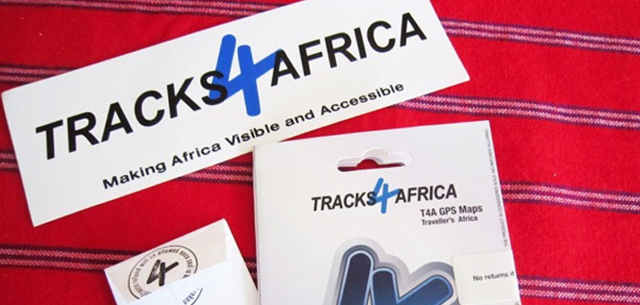
WHO AND WHAT IS TRACKS4AFRICA?
Tracks4Africa (T4A) offer GPS maps that have the ability to navigate you from Cape to Cairo. It’s that simple.
They make Africa visible and accesible. In fact that’s their mission. And in their heart of heart’s they want the World to know how easy and safe most countries in Africa are to travel.
In our words? They make overlanding in Africa POSSIBLE.
The incredible thing about Tracks4Africa is the tracks and the way-points have come from REAL travellers who have gone before you. And as we travel, we ourselves will be endeavouring to record and submit our tracks and waypoints to the Tracks4Africa data set.
You can use Garmin software MapSource in combination with T4A GPS maps to plot out routes prior to departure on your computer. And, depending how well planned you are you can even use the map data to pinpoint where you are going to camp, eat and even buy your groceries. Or use it on the fly as you go.
The quality of T4A products is quite incredible. You can tell they are created by a company who cares (a lot). One example is their paper maps, which are in fact NOT paper maps. They are maps created with tear and water resistant PolyArt paper which is perfect for the outdoors. T4A have also paid attention to how the user folds and holds the maps. The attention to detail is nothing short of incredible and we are well and truly impressed.
TRACKS4AFRICA WILL GUIDE AUSSIE OVERLANDERS THROUGH AFRICA
Here’s an up close look at the gear that will be guiding the Aussie Overlanders throughout Africa:

^^ T4A GPS Maps on SD card. Our full set of GPS Africa maps.

^^ This micro-SD card is has the data to get us around Africa. Incredible.


^^ Namibia paper map, Botswana paper map, Mozambique & Malawi paper map.

^^ Paper maps are ACTUALLY NOT PAPER! #OMG! They are tear and water resistant PolyArt paper which is perfect for the outdoors. #YES

^^ Each track on the ‘paper’ map is shown in both Kilometres and time. The time to travel is calculated based on real travellers data (the average). Outrageously helpful when planning the drive ahead.


^^ Camping & Lodging Directory: Nambia & Botswana – complete with detailed listings of where to stay and some photos.


^^ Colour coded maps and index. Help-full!


^^ If you are in Africa the best way to get your hands on T4A is via the website www.tracks4africa.co.za, where the GPS maps are available for immediate download.
If you are in Australia your best way is through the awesome Aussie distributor Mike at Self Drive Safaris www.selfdrivesafaris.com.au. Based in Bowral, NSW he can have the gear couriered straight to you. We were lucky enough to spend some time with Mike and his lovely wife Linda. Will fill you in on the next Wrap Up.
![]()
So there you have it. This is the Tracks4Africa gear that will be helping us get through Africa. We will also bring a detailed Atlas with us for extra reference when further North or if the GPS and the spare GPS go ka-plonk.
We are so grateful that Tracks4Africa exists and that they are supporting our expedition. It is unfathomable to imagine crossing the continent without their GPS data.
As we travel we’ll endeavour to save our tracks and way-points to share at the end of our journey.
Cheers
![]()
*** Follow the expedition at www.facebook.com/aussieoverlanders ***